The map below is a clickable reference to the counties in Calgary area of Alberta. Just click on the area of the map where you'd like to find a farmer's market, farm stand, roadside market or garden market! Just press the BACK key to return to the previous page or use the quick links at left!
Alberta Regions / Areas Map
Click on your area on the map!
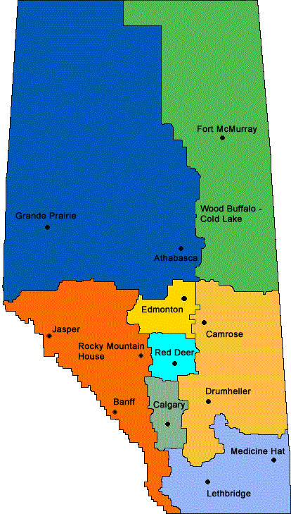
There seems to be no commonly agreed-upon way to organize or subdivide Alberta,
so I've roughly adopted the Indian regions map, as it appears to group areas
by population centers as well as geography.
Yellow = Edmonton area
Light Orange / Tan = Camrose-Drumheller area
Light blue = Red Deer area
Gray = Calgary area
Blue-purple = Southeast Alberta, including Medicine Hat and Lethbridge
Blue = Northwest Alberta, including Grand Prairie and Athabasca
Green = Northeast Alberta, including Fort McMurray
Orange = Southwest Alberta, including Banff, Jasper and Rocky Mountain House
Do you know of any more farmer's markets, farm stands, etc. in Calgary area of Alberta? Please tell me about them - Click here to write to me!
Get the
most recent version of
the Ball Blue Book of Home Canning
Find other types of farms:
- Easter egg hunts
- Children's consignment sales
- Farm markets and roadside stands
- Local Honey
- Local Meat, Milk and Eggs
Maple Syrup Info: - Maple syrup nutrition facts
- Maple syrup production methods and history
- Tapping trees and making your own maple syrup from maple sap
- Maple syrup production facts and figures
- Pumpkin pie from a fresh pumpkin with maple syrup! (wonderful!)
- Maple Syrup Ice cream ( with a gel-canister ice cream maker)
- Maple Syrup Ice Cream (with a ice cream maker that uses ice and salt)
Related: - Road trip and camping
- Pumpkin patches and corn mazes
- Christmas Tree Farms and lots
Highly rated canning supplies:
- Canning accessories kit: funnel, jar tongs, lid lifter, etc
- Food Dehydrator, 400W Electric with 8 Trays, 48 hour Timer and Temperature Control 95-176℉, BPA-Free
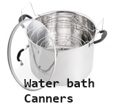
- Water Bath Canner, 21 Qts with lid, Jar Rack, Speckled Black, cans 7 quart jars, 9 pint jars or 13 half-pint jars
- Air Fryer: Instant Pot Instant Vortex Plus XL 8QT Clear Windows, Custom Programming, 8-in-1 Functions that Crisps, Broils, Roasts, Dehydrates, Bakes, Reheats
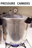
- Pressure canner: All American 921, 21.5qt Pressure Cooker/Canner, never needs gaskets, Great for Gas, Electric or Flat Top Stoves - Made in the USA
- The Backyard Homestead: a guide to homesteading , on 1/4 acre, how to raise grains and vegetables; raise animals for meat, eggs, and dairy; and keep honey bees
- HEPA Air Purifiers for Home, Large Rooms for Allergies, Smoke, Pets. Eliminates 99.97% of Dust, Pet Hair, Odors